This was a delightful series of mistakes we will never forget. We got engaged in Edinburgh and wanted to see more of Scotland for a honeymoon trip. But we couldn't decide on a single location for the trip.
| Distance | 345km |
|---|---|
| Avg. Speed | 10.8km/h |
| Ascent | 2350m |
| Descent | 2190m |
| Bike time | 1-09:00:00 |
In the end, we picked a general area, the Cairngorms, and planned an ambitious bike trip around it. We had only done a few weekend trips at this point, with no experience biking in Scottish hills. Normally, we aim for 50 km (31.07 miles) on a bike day but we tried to avoid over 30 km (18.64 miles) most days for this trip (with one spectacular failure in this regard).
We were very careless with several crucial factors:
Elevation
You will encounter a lot of hills in Scotland. Some of them will be gentle, rolling hills I like to call carousel hills. These are quite enjoyable because you get a lot of momentum from the descent of the previous hill and are halfway up the next one before you have to pedal again.
Other hills are there for you to die on. They go forever with false flats or torture you with short, steep gradients or present a diabolical combination of the two that will make you question every decision in your life that led you to this point.
There's not much you can do about the murder hills other than mentally prepare for a bad time and look for a good cafe at the top or along the descent.
Surfaces
You don't go as fast on dirt or gravel as you do on asphalt. Sounds obvious now. But I don't think we even looked at surfaces when planning this trip. We went to Google Maps, put in a start and end location, clicked the little bike icon and assumed everything would be fine. Surely Google wouldn't put us on a mountain bike trail in the middle of nowhere? (see Dalmunzie, Day 1)
Well, at least it wouldn't expect us to be on busy A-roads with giant logging trucks zooming past? (see Ballater, Day 3) Yes, the other thing to keep in mind with surfaces is whether the smooth, well-maintained asphalt is worth the highway traffic that comes with it. Given the choice, I'll take the quieter, bumpier B-road any day.
Wind
A lot of well-known bike routes come with suggestions of the direction to travel in based on prevailing wind patterns. This is nothing to sniff at. A tailwind (pushing you forwards) offers a welcome boost while a headwind (pushing you backwards) can double your expected travel duration.
The more exposed you are, the stronger the wind will be. We learned this lesson repeatedly on multiple ski hills. A strong Scottish wind, regardless of direction, will be loud and cold. Bring layers and consider a headband or buff to cover your ears if you value your hearing.
Quite frankly, most bike days on this trip were a disaster. But we would both do it again in a heartbeat.
Dalmunzie
Bike Day 1
| Distance | 28km |
|---|---|
| Avg. Speed | 4.8km/h |
| Ascent | 720m |
| Descent | 470m |
| Bike time | 5:55:00 |
We barely survived the first ride. Google Maps took us off road for the last 12 km (7.46 miles) or so. We had done very well with the first bit on undulating and zigzagging asphalt road. We were completely unprepared for the Cateran trail.
Trail is a generous word. There were occasional signposts and the merest wisp of a path through the grass. For two hours we saw nothing but mountains and sheep.
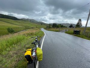
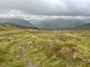
Panic set in around 18h. We were done. Legs and arms aching from pushing our bikes up this can-you-even-call-it-a-path. Google Maps started to diverge from the signposts. We had no idea where to go and the clouds rolled in again, threatening downpour.
Never trust the maps of Google
Jack made the call to ignore Google and stick to the "marked trail", which was wise. I reached the signpost we had designated as a re-grouping point first and called Dalmunzie, our hotel, which was the only point we had a cell signal.
There are no words to express the relief I felt when I told the receptionist we were on the Cateran trail and she said, “Oh, I know exactly where you are.” That made one of us. We had stopped about 30ft from the peak and, on the other side, a rocky downhill slope led to the road and Dalmunzie Hotel.
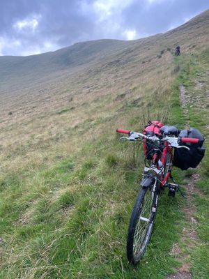
We limped to Dalmunzie. Jack collapsed on the grass outside and I went to reception to check in. When I came out, he was still on the ground.
I said the warranty on a new husband must still be good. I should trade him in for a newer model. He said they wouldn't take him back. His condition was due to the user's fault.
Braemar
Bike Day 2
| Distance | 25km |
|---|---|
| Avg. Speed | 9.9km/h |
| Ascent | 340m |
| Descent | 370m |
| Bike time | 02:37:00 |
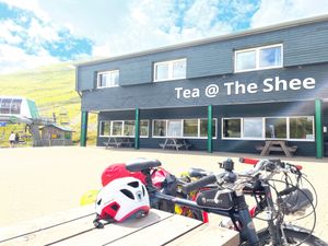
We climbed another mountain today. At least this time it was on the road.
Stopped at Glenshee Ski Centre for Tea @ the Shee. Two old goldens at the picnic bench next to ours. They couldn’t have been happier to climb the mountain themselves. Terminally good-natured dogs.
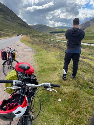
Descent into Braemar was unreal. Layers of mountains like a painting. Green and yellow in the foreground. Blue and purple in the distance. A perfect little stream running alongside the road.
Busier road than usual. We did turn off the highway to continue following the Old Military Road, but it was a moment of trepidation considering all Google Maps put us through Saturday.
The Old Military Road
The Old Military Road in the Scottish Highlands was constructed around mid 18th century by the British army to be able to control the clans after the (second) Jacobite rebellion of 1715. The road starts from the central lowlands and stretches to the Inverness with fortified barracks. It was, perhaps, most famously used to expedite Bonnie Prince Charlie's Jacobite army's descent towards London in 1744-45.
We spend our rest day walking along the river paths and watch the Clunie Water from The Bothy Braemar. We were unable to go into the Braemar castle, as it was closed on that day. For dinner we ended up going to the only place that was open and did not require any reservations, Farquharson's Bar and Kitchen where we had the most unexpected and delicious cheesecake ever.
Ballater
Bike Day 3
| Distance | 29km |
|---|---|
| Avg. Speed | 7km/h |
| Ascent | 190m |
| Descent | 210m |
| Bike time | 4:13:00 |
Difficult ride to Balmoral. Jack was miles ahead of me the whole way and it was a busy road (logging trucks are the worst). The views were stunning as usual. And the elevation changes were not too severe. I had to ask Jack to slow down, which he sort of did and I sort of felt better.
Sadly, when we got to Balmoral Castle, there was nothing to see from the public entrance. One would have to pay the entrance fee, find a place to lock bikes and check or carry bags. Not gonna happen. Rain started getting heavier so we added splash pants. It was a good call. Rained on and off for the rest of our ride.
We tried to stop at another castle on the way to Ballater but it was on private property. 0 for 2.
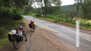
That said, we made a great time to Ballater, arriving around 13h after having left at 10h30. Definitely a good idea to avoid the massive inclines we would have faced going direct from Braemar to Candacraig.
Ballater is bigger than Braemar. More restaurants and cafes. More sprawl of commercial streets.
We got lunch takeaway from a butcher’s called Sheridan’s. Luckily there was a friendly bike shop with nice outdoor seating where we had our lunch, Cycle Highlands. I was tempted by Shorty’s ice cream but it was too cold. Then we found a cafe with outdoor seating, Rocksalt & Snails (at the time we write this it seems like their cafe is permanently closed). Bailey’s hot chocolate with cream and marshmallows for me. Cappuccino for Jack. Jack was still craving cheesecake so I got the only one on offer: lemon meringue. Not quite as good as the honeycomb one from Farquharson's in Braemar the night before.
On the way from Ballater to Candacraig, we immediately overheated and felt sick. The sweaters came off. The cheesecake was regretted. There wasn’t a ton of incline, but there was enough and we walked a good portion of it on cold, tired, sore legs.
We lucked out the next day. Even though the regular Highland Games were canceled due to COVID, there was a community version that was equal parts exciting and heartwarming.
Tomintoul
Bike Day 4
| Distance | 44km |
|---|---|
| Avg. Speed | 12.7km/h |
| Ascent | 630m |
| Descent | 610m |
| Bike time | 03:32:00 |
Not terribly difficult first peak on way to Tomintoul (pronunciation). True test of strength and stamina (and wind resistance) was over the second peak, Lecht ski hills.
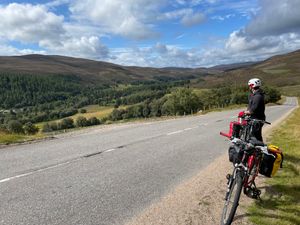
Clouded over, windy, and threatening a storm. We thought we reached the top only to find a slight decline followed by another peak.
Stopped at Lecht cafe (the highest roadside bar in Scotland, according to the sign-out front) for much-needed hot drinks and Jack’s treat: donuts.
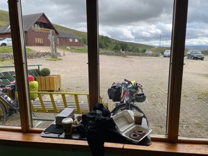
Downhill rest of the way. But with the wind, you still had to pedal! Wild. Unforgettable.
We were unable to find a place to warm up in Tomintoul with the bikes so went a little early to our accommodation, a quiet, secluded spot which was worth every foot of elevation.
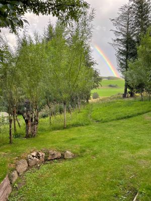
We even got a beautiful rainbow on arrival.
And the next day, we visited The Glenlivet (pronunciation) distillery.
10/10, would visit again (both yurt and distillery).
Boat of Garten
Bike Day 5
| Distance | 24km |
|---|---|
| Avg. Speed | 12.3km/h |
| Ascent | 190m |
| Descent | 210m |
| Bike time | 1:58:00 |
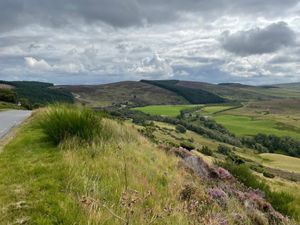
Too tired for full sentences. Bullet points only:
- Off at 10h30-ish
- High, windy biking
- Fast, fancy cars
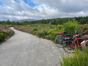
- Nice forest section
- Jack wants new legs
- Boat of Garten! Drop bags
- Buy train tickets to Aviemore (pronounced Ah-vee-more)
- Round trip Aviemore to Broomhill (with tea and extra scones!)
- 40min bike back, off road bits otherworldly
- Bikes stored
- Dinner 18h45
Blair Atholl
Bike Day 6
| Distance | 86km |
|---|---|
| Avg. Speed | 13.6km/h |
| Ascent | 190m |
| Descent | 210m |
| Bike time | 6:20:00 |
This was the result of some bad luck.
Our original accommodation in Dalwhinnie called about a month before the trip to tell us they were going out of business. They suggested a few other options in the area but those were already fully booked.
There were lots of options if we wanted to stop further North, but we had to catch a train on our last day, so decided to push on South.
Yeah.
We left closer to 10h than 9h30. Jack immediately felt weak. Not sore. Just not able to push pedals at all. I didn’t know what to do about this other than go slow and take breaks as needed.
We reached Newtonmore around 12h30 and couldn’t pass up the opportunity to visit the Highland Folk Museum on such a sunny day. We walked to the older part of the museum and a poor volunteer in period clothes greeted us. I say poor because he was sitting in the sun and it was extremely hot. He already had the beginnings of a sunburn.
There were no plaques on the exhibits so it was great to have him give us the rundown of what we were looking at. And extra info on those distinctive roofs (made of heather because it sticks like velcro, and sloped steeply to serve as both roof and walls to avoid snow accumulation). It was incredibly dark inside. Jack needed to use his phone flashlight to see the details of the beds and cookery.
We got back on the road and arrived at Dalwhinnie Distillery around 15h30. Jack was still having a lot of trouble.
I bought a small 15-year Dalwhinnie (pronunciation) to taste later and went down the road to the Snack Shack, which was easily our most disappointing pit stop. The waitress was chasing two ducks stealing customer's meals, which was not happening for the first time! However, it seemed to give Jack his second wind (eventually).
We were assisted by several long downhill slopes. The weather remained beautiful and we had some excellent views of the mountains and a winding river and horse pastures.
The best view of all, of course, was Atholl Arms at the end of the day. We were both thoroughly exhausted.
Pitlochry
Bike Day 7
| Distance | 11km |
|---|---|
| Avg. Speed | 15.1km/h |
| Ascent | 90m |
| Descent | 110m |
| Bike time | 0:46:00 |
My back tire punctured somewhere on the way home from the House of Bruar yesterday. It was totally flat when we collected the bikes to check out of Atholl Arms.
Relatively easy ride to Pitlochry (once Jack pumped my tire back to life). I passed Jack going up a hill. Man watching from the bus stop told him he would need a motor to keep up with me. Jack said he wanted to tie a rope to my bike and get towed.
Drinks and lunch at Old Mill Inn (not a working mill, Jack noted with disappointment). We wandered over to the station early and I bought some books from the second-hand bookshop.
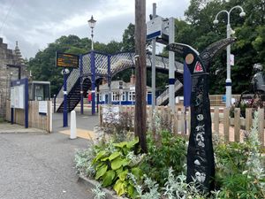
Devastation upon the train’s arrival. It was packed. People sitting all over our cycle rack. An old lady disembarking took one look at our bikes, laughed, and muttered, “Not a chance.”
Not a chance.
The apologetic and frazzled conductor said he had not an inch of space. He’d phone ahead to the next train to ask for room for us.
We were stranded. The ticket office closed early. Jack was on the phone with Scotrail and I was on the phone with the Pitlochry tourist office to hear if there were any other options to Edinburgh. In the end, after an extremely long and stressful wait, we were able to get on an indirect train and spent the night as expected in Market Street Hotel.
We were both a bit overwhelmed by the noise and size of Edinburgh after two weeks of relatively quiet countryside.
On arriving back home in Durham the next day, I was pleased to remember we had stocked the freezer with a ready-made pizza. We ate it immediately, looked at each other, and decided to order Domino's as well.